
April 20th, 2025 Local News
Park Hills, Mo. (KFMO) - A potentially dangerous weather setup is unfolding across Missouri this Easter Sunday, with a line of severe thunderstorms expected to develop this afternoon across the western part of the state and track eastward through the evening hours.
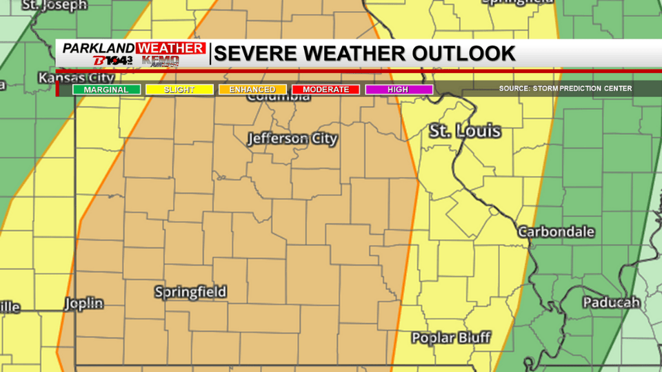
The National Weather Service warns that all forms of severe weather are possible, including large hail, damaging winds, and tornadoes. The primary threats with these storms are damaging wind gusts up to 70 miles per hour and tornadoes—some of which could be strong and long-tracked. Hail up to the size of golf balls is also possible. A few strong EF-2 tornadoes cannot be ruled out, especially in areas under an enhanced risk.
The majority of the Parkland region, including St. Francois, Washington, Ste. Genevieve, Iron, Madison, and Jefferson Counties, is under a slight risk for severe weather. However, the western portion of the area falls within an enhanced risk, where the environment may support more intense storms.
The severe weather threat for the Parkland is expected between 6 p.m. and 10 p.m. this evening. Storms will likely weaken as they move further east, but residents are urged to remain weather aware throughout the evening hours.
A Flood Watch remains in effect through tonight, primarily for river flooding. While one final round of rain is expected alongside this evening’s thunderstorms, the storms are expected to move quickly, keeping the flash flooding threat low.
Residents should review their severe weather safety plans and ensure they have multiple ways to receive weather alerts. Stay tuned to local forecasts for updates as conditions evolve.