April 2nd, 2025 Local News
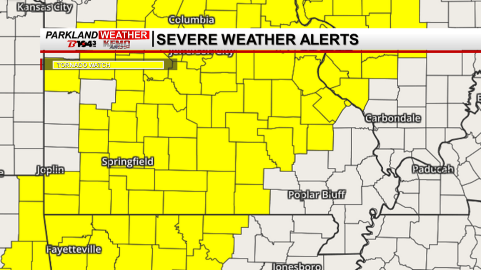
Park Hills, Mo. (KFMO) - Southeast Missouri is facing an Enhanced Risk of severe weather on Wednesday, with the potential for dangerous thunderstorms developing in the afternoon and continuing into the evening. The National Weather Service warns that all hazards are possible, including large hail, damaging winds, and tornadoes, with the greatest tornado risk centered on southeastern and far east-central Missouri, as well as southwest and south-central Illinois.
Severe storms may begin as early as late morning, but the most active period is expected in the afternoon and evening hours. Atmospheric conditions will support severe storm development, including strong vertical wind shear, unstable air, and adequate lift to produce significant weather impacts.
What’s Still Uncertain?
While confidence is growing in the severe weather potential, several factors remain uncertain:
Storm Location: Early morning showers and storm boundaries could influence where the most intense storms develop.
Storm Coverage: At least scattered severe storms are expected, but they could become more widespread with higher impacts.
Storm Intensity: The potential for hail larger than two inches, damaging winds over 75 mph, and strong tornadoes is increasing but not yet fully certain.
The KFMO B104 News team will continue to monitor this developing weather situation and provide updates as new information becomes available. Stay tuned for the latest forecasts and be prepared to take action if warnings are issued.